Earthquake damages 40 houses in Sumatra
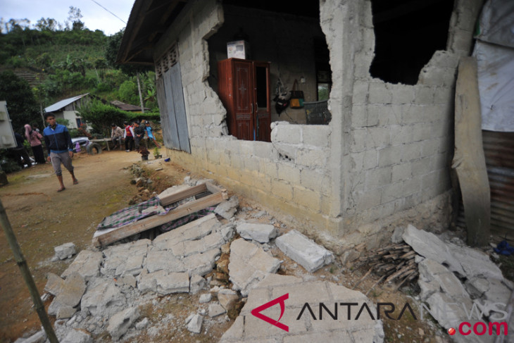
A house was damaged by an earthquake in Solok, West Sumatra Province. (ANTARA FOTO/Iggoy el Fitra)
PADANG ARO, Feb 28, 2019, ANTARA. A 4.8-magnitude tectonic earthquake hitting Sangir Balai Janggo Sub-district, South Solok District, West Sumatra Province, on Thursday at 1:55 Western Indonesian Standard Time (WIB) damaged 40 houses, according the South Solok Regional Disaster Management Office (BPBD), reported the ANTARA.
“Information on the temporary data collected following the South Solok earthquake indicated moderate damage to 36 houses and severe damage caused to four houses,” District BPBD Prosecutor Johny Hasan Basri stated in Padang Aro on Thursday.
Currently, 30 houses in Nagari Talunan Maju and 10 houses in Nagari Sungai Kunyit have incurred moderate damage, while six houses and four others are severely damaged.
In addition, he remarked that as many as 11 people suffered slight injuries.
Most fatalities were reported in Kunyit River, with 10 people, and one person in Talunan currently being offered care.
He said temporary measures were taken in the form of health posts opened in Sungai Kunyit and TRC conducting an on-field assessment.
“Officers are still conducting data collection on the field,” he remarked.
According to BMKG Padang Panjang, the epicenter of this earthquake is on land at coordinates 1.59 degrees South Latitude and 101.27 degrees East Longitude, precisely 19 kilometers Southwest of South Solok District, at a depth of 11 kilometers.
Taking into account the location of the epicenter and hypocenter depth, the earthquake that hit South Solok District was a shallow crustal type quake that occurs due to activities of the Sumatra Fault Zone.
According to the report from the community, the tremor was felt in South Solok at around II Scale of the Earthquake intensity BMKG (SIG-BMKG), or between II-III MMI (modified mercalli intensity).
Reporting by Mario Sofia Nasution, Eliswan Azly